Fáìlì:Michael Levitt.jpg

Ìtóbi ìkọ́yẹ̀wò yìí: 591 × 600 pixels. Àwọn ìgbéhàn míràn: 236 × 240 pixels | 473 × 480 pixels | 756 × 768 pixels | 1,009 × 1,024 pixels | 1,840 × 1,868 pixels.
Fáìlì àtìbẹ̀rẹ̀ (1,840 × 1,868 pixel, ìtóbi faili: 1,015 KB, irú MIME: image/jpeg)
|
|
Fáìlì yìí wá láti Wikimedia Commons. Àròyé láti ojúewé ìjúwe rẹ̀ níbẹ̀ nìyí nísàlẹ̀. |
Àkótán
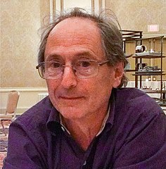
| Ìjúwe | Michael Levitt at the Biophysical Society meeting, 2013 |
| Ọjọ́ọdún | |
| Orísun | Iṣẹ́ onítọ̀hún |
| Olùdá | Keilana |
| Camera location | | View this and other nearby images on: OpenStreetMap |
|---|
| Upload method |
|---|
Ìwé àṣẹ
| Èmi gangan, tó jẹ́ pé èmi ni mo ni ẹ̀tọ́àwòkọ iṣẹ́ yìí, jọ̀wọ́ ìṣẹ́ yìí sínú ìgboro. Èyí kan gbogbo ayé. In some countries this may not be legally possible; if so: I grant anyone the right to use this work for any purpose, without any conditions, unless such conditions are required by law. |
Ìtàn fáìlì
Ẹ kan kliki lórí ọjọ́ọdún/àkókò kan láti wo fáìlì ọ̀ún bó ṣe hàn ní àkókò na.
| Ọjọ́ọdún/Àkókò | Àwòrán kékeré | Àwọn ìwọ̀n | Oníṣe | Àríwí | |
|---|---|---|---|---|---|
| lọ́wọ́ | 10:25, 25 Oṣù Kẹta 2014 | | 1,840 × 1,868 (1,015 KB) | Lebaronet | cropped |
| 10:15, 25 Oṣù Kẹta 2014 |  | 1,840 × 2,192 (1.14 MB) | Lebaronet | crop | |
| 12:17, 9 Oṣù Kẹ̀wá 2013 |  | 1,840 × 3,264 (3.94 MB) | Ctruongngoc | améliorations couleurs luminosité | |
| 04:41, 4 Oṣù Kejì 2013 |  | 1,840 × 3,264 (1.41 MB) | Keilana |
Ìlò fáìlì
Ojúewé kan yìí únlo fáìlì yí:
Ìlò fáìlì káàkiri
Àwọn wiki míràn wọ̀nyí lo fáìlì yìí:
- Ìlò ní af.wikipedia.org
- Ìlò ní als.wikipedia.org
- Ìlò ní arz.wikipedia.org
- Ìlò ní as.wikipedia.org
- Ìlò ní azb.wikipedia.org
- Ìlò ní az.wikipedia.org
- Ìlò ní be.wikipedia.org
- Ìlò ní bn.wikipedia.org
- Ìlò ní br.wikipedia.org
- Ìlò ní ca.wikipedia.org
- Ìlò ní ckb.wikipedia.org
- Ìlò ní cs.wikipedia.org
- Ìlò ní da.wikipedia.org
- Ìlò ní en.wikipedia.org
- Ìlò ní es.wikipedia.org
- Ìlò ní fi.wikipedia.org
- Ìlò ní fr.wikipedia.org
- Ìlò ní he.wikipedia.org
- Ìlò ní hi.wikipedia.org
- Ìlò ní hr.wikipedia.org
- Ìlò ní hu.wikipedia.org
- Ìlò ní id.wikipedia.org
- Ìlò ní incubator.wikimedia.org
- Ìlò ní io.wikipedia.org
- Ìlò ní it.wikipedia.org
- Ìlò ní ja.wikipedia.org
- Ìlò ní ka.wikipedia.org
- Ìlò ní kk.wikipedia.org
- Ìlò ní ko.wikipedia.org
- Ìlò ní ku.wikipedia.org
- Ìlò ní la.wikipedia.org
- Ìlò ní lv.wikipedia.org
- Ìlò ní mk.wikipedia.org
- Ìlò ní ml.wikipedia.org
Ìfihàn ìlò míràn púpọ̀ fún fálì yìí.