Fáìlì:Gc01.jpg
Ìtóbi ìkọ́yẹ̀wò yìí: 550 × 599 pixels. Àwọn ìgbéhàn míràn: 220 × 240 pixels | 441 × 480 pixels | 705 × 768 pixels | 940 × 1,024 pixels | 1,880 × 2,048 pixels | 4,135 × 4,505 pixels.
Fáìlì àtìbẹ̀rẹ̀ (4,135 × 4,505 pixel, ìtóbi faili: 3.85 MB, irú MIME: image/jpeg)
|
|
Fáìlì yìí wá láti Wikimedia Commons. Àròyé láti ojúewé ìjúwe rẹ̀ níbẹ̀ nìyí nísàlẹ̀. |
Àkótán
| Ìjúwe |
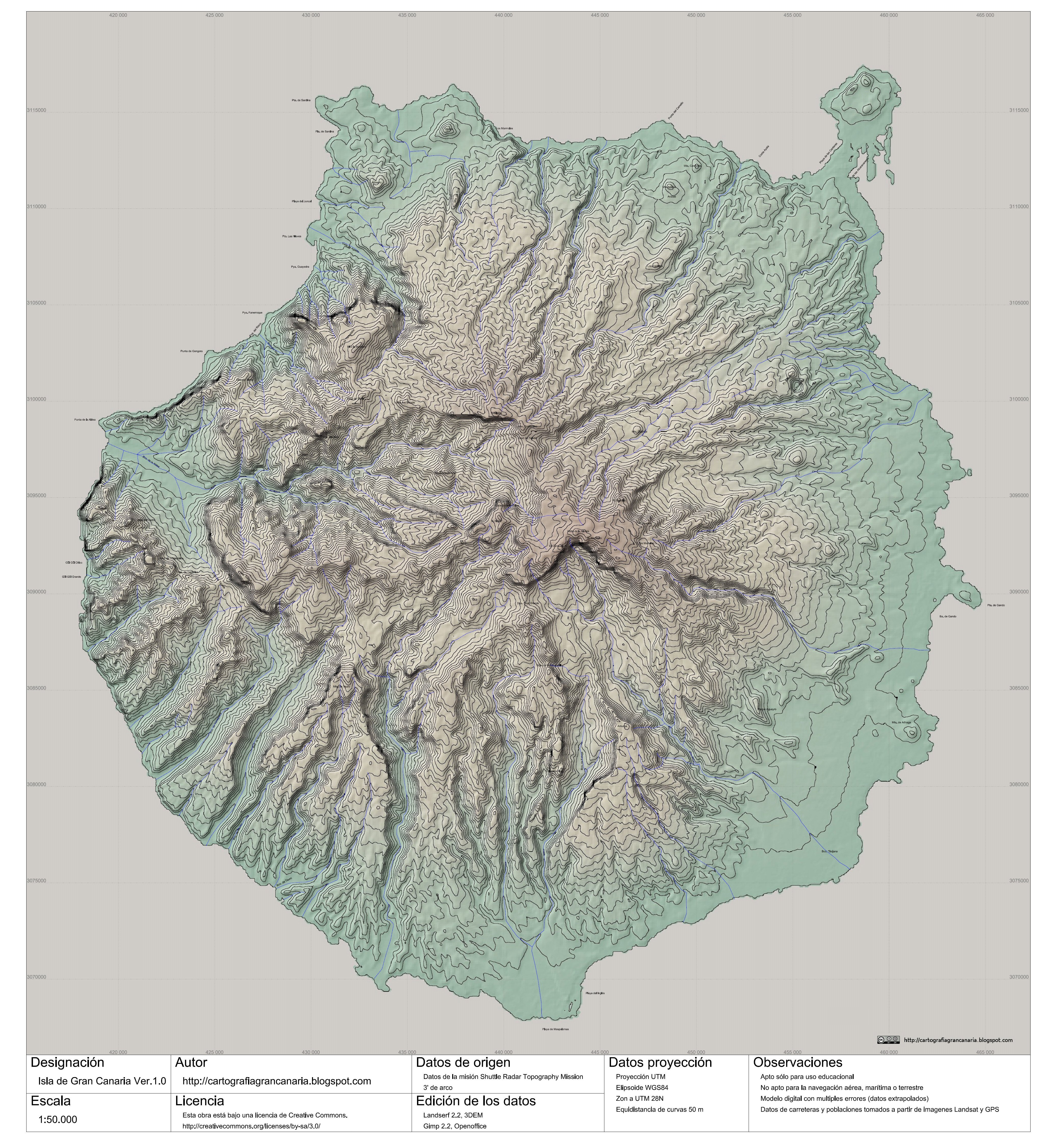
English: Topographic map of the Gran Canaria Island (Canary Islands) Spain. Scale 1:50.000.
Español: mapa topográfico de la isla de Gran Canaria (Islas Canarias) España. Escala 1:50.000.
|
| Ọjọ́ọdún | |
| Orísun | http://cartografiagrancanaria.blogspot.com/2007/10/gran-canaria-150000-para-la-wikipedia.html |
| Olùdá | Cartografiagrancanaria @ Cartografiagrancanaria.blogspot.com. |
| Ìyọ̀nda (Ìtúnlò fáìlì yìí) |
Fáìlì yìí wà lábẹ́ ìwé àṣẹ Creative Commons Ìdálórúkọ-Share Alike 3.0 Aláìkówọlé.
English: Notes: Educative use only. Use nonallowed for the airplane navigation, marine or terrestrial. Digital model with multiple errors. Data of roads and populations taken from Landsat images and GPS.
Español: Observaciones: Apto sólo para uso educacional. No apto para la navegación aérea, marítima o terrestre. Modelo digital con múltiples errores. Datos de carreteras y poblaciones tomados a partir de imágenes Landsat y GPS. |
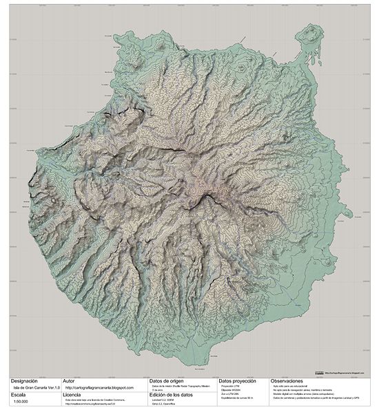
| Àwọn àtẹ̀jáde míràn | Cropped & without watermark: Image:Gc01 cropped&no watermark.jpg |

|
This file has been superseded by Gc01 cropped&no watermark.jpg. It is recommended to use the other file. Please note that deleting superseded images requires consent. Reason to use the other file: "image without watermarks"
|

|
Ìtàn fáìlì
Ẹ kan kliki lórí ọjọ́ọdún/àkókò kan láti wo fáìlì ọ̀ún bó ṣe hàn ní àkókò na.
| Ọjọ́ọdún/Àkókò | Àwòrán kékeré | Àwọn ìwọ̀n | Oníṣe | Àríwí | |
|---|---|---|---|---|---|
| lọ́wọ́ | 19:16, 6 Oṣù Kẹ̀wá 2007 | | 4,135 × 4,505 (3.85 MB) | Cartografiagrancanaria | |
| 18:17, 5 Oṣù Kẹ̀wá 2007 |  | 4,135 × 4,505 (3.86 MB) | Cartografiagrancanaria | {{Information |Description= |Source=self-made |Date= |Author= Cartografiagrancanaria }} |
Ìlò fáìlì
Ojúewé kan yìí únlo fáìlì yí:
Ìlò fáìlì káàkiri
Àwọn wiki míràn wọ̀nyí lo fáìlì yìí:
- Ìlò ní ca.wikipedia.org
- Ìlò ní en.wikipedia.org
- Ìlò ní hr.wikipedia.org
- Ìlò ní hu.wikipedia.org
- Ìlò ní ms.wikipedia.org
- Ìlò ní nn.wikipedia.org
- Ìlò ní pt.wikipedia.org
- Ìlò ní tr.wikipedia.org