Fáìlì:India Uttar Pradesh location map.svg

Fáìlì àtìbẹ̀rẹ̀ (faili SVG, pẹ̀lú 1,006 × 981 pixels, ìtòbi faili: 776 KB)
|
|
Fáìlì yìí wá láti Wikimedia Commons. Àròyé láti ojúewé ìjúwe rẹ̀ níbẹ̀ nìyí nísàlẹ̀. |
Àkótán
| Ìjúwe |
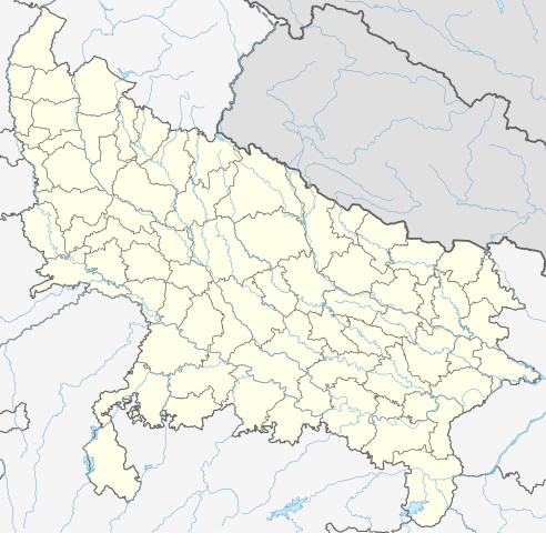
Quadratische Plattkarte, N-S-Streckung 112 %. Geographische Begrenzung der Karte:
Equirectangular projection, N/S stretching 112 %. Geographic limits of the map:
|
|
| Ọjọ́ọdún | ||
| Orísun |
Iṣẹ́ onítọ̀hún, using
|
|
| Olùdá | NordNordWest | |
| Ìyọ̀nda (Ìtúnlò fáìlì yìí) |
Fáìlì yìí wà lábẹ́ ìwé àṣẹ Creative Commons Ìdálórúkọ-Share Alike 3.0 Jẹ́mánì.
 Fáìlì yìí wà lábẹ́ ìwé àṣẹ Creative Commons Ìdálórúkọ-Share Alike 3.0 Jẹ́mánì.
|


|
This map has been made or improved in the German Kartenwerkstatt (Map Lab). You can propose maps to improve as well.
|
Ìtàn fáìlì
Ẹ kan kliki lórí ọjọ́ọdún/àkókò kan láti wo fáìlì ọ̀ún bó ṣe hàn ní àkókò na.
| Ọjọ́ọdún/Àkókò | Àwòrán kékeré | Àwọn ìwọ̀n | Oníṣe | Àríwí | |
|---|---|---|---|---|---|
| lọ́wọ́ | 06:40, 1 Oṣù Kàrún 2023 | | 1,006 × 981 (776 KB) | C1MM | c borders |
| 04:44, 5 Oṣù Kínní 2022 |  | 1,066 × 927 (777 KB) | C1MM | Corrected rivers and dist boundaries | |
| 22:54, 12 Oṣù Kejì 2021 |  | 909 × 886 (262 KB) | C1MM | Added Chhattisgarh | |
| 00:41, 8 Oṣù Kínní 2021 |  | 909 × 886 (261 KB) | C1MM | Added Amethi district | |
| 21:29, 22 Oṣù Kẹrin 2020 |  | 909 × 886 (249 KB) | NordNordWest | Reverted to version as of 19:51, 9 October 2012 (UTC); no need to change colours | |
| 21:00, 22 Oṣù Kẹrin 2020 |  | 909 × 886 (292 KB) | C1MM | Fixed rivers | |
| 20:51, 22 Oṣù Kẹrin 2020 |  | 909 × 886 (290 KB) | C1MM | Fixed colors and made rivers along borders | |
| 19:51, 9 Oṣù Kẹ̀wá 2012 |  | 909 × 886 (249 KB) | NordNordWest | =={{int:filedesc}}== {{Information |Description= {{de|Positionskarte von Uttar Pradesh, Indien}} Quadratische Plattkarte, N-S-Streckung 112 %. Geographische Begrenzung der Karte: * N: 30.5° N * S: 23.8° N * W: 77.... |
Ìlò fáìlì
Ojúewé kan yìí únlo fáìlì yí:
Ìlò fáìlì káàkiri
Àwọn wiki míràn wọ̀nyí lo fáìlì yìí:
- Ìlò ní ar.wikipedia.org
- Ìlò ní as.wikipedia.org
- Ìlò ní awa.wikipedia.org
- Ìlò ní azb.wikipedia.org
- اتاوه
- کینتور
- علیپورا
- فولپور
- فولی (هیندوستان)
- ففنا (هیندوستان)
- فارندا
- سارسای ناوار
- ساروخیپورا
- ساراوان, جاونپور
- ساراسارا, یوتار پرادش
- ساراییا بور
- سارایبیرو
- مداوارا کالا
- سانخنی
- ماوجامپور
- ماسکانوا
- سانای, بوداون
- سامرر (هیندوستان)
- کالاند, ایندیا
- مارتین پوروا
- سامبالهرا
- کاکورا
- سالارپور, بوداون
- کایتورا, جاونپور
- ساییان, آقرا
- ساینتال, یوتار پرادش
- سایفای
- کاقارول
- سایدناقار
- ساهاجانپور
- هالاور
- سافدارقانج
- سادپور, یوتار پرادش
- روپایدیها
- رابارلی
- کادار چووک
Ìfihàn ìlò míràn púpọ̀ fún fálì yìí.