Fáìlì:Nigeria Local Government Areas.png
Ìtóbi ìkọ́yẹ̀wò yìí: 800 × 527 pixels. Àwọn ìgbéhàn míràn: 320 × 211 pixels | 640 × 421 pixels | 1,024 × 674 pixels | 1,280 × 843 pixels | 1,601 × 1,054 pixels.
Fáìlì àtìbẹ̀rẹ̀ (1,601 × 1,054 pixel, ìtóbi faili: 71 KB, irú MIME: image/png)
|
|
Fáìlì yìí wá láti Wikimedia Commons. Àròyé láti ojúewé ìjúwe rẹ̀ níbẹ̀ nìyí nísàlẹ̀. |
Birnin magaji
Àkótán
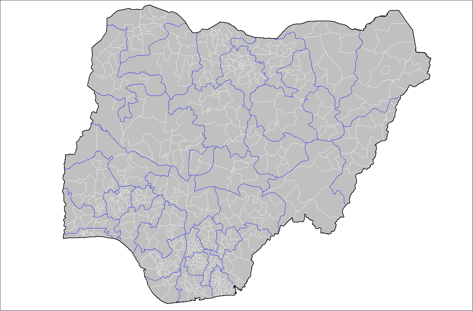
| Ìjúwe | Map of the local government areas of Nigeria. Created by Rarelibra 15:42, 12 July 2007 (UTC) using MapInfo Professional v8.5 and various mapping resources. |
| Ọjọ́ọdún | 12 Oṣù Keje 2007 (original upload date) |
| Orísun | No machine-readable source provided. Own work assumed (based on copyright claims). |
| Olùdá | No machine-readable author provided. Rarelibra assumed (based on copyright claims). |
Ìwé àṣẹ
| This work has been released into the public domain by its author, I, Rarelibra. This applies worldwide. In some countries this may not be legally possible; if so: I, Rarelibra grants anyone the right to use this work for any purpose, without any conditions, unless such conditions are required by law. |
Ìtàn fáìlì
Ẹ kan kliki lórí ọjọ́ọdún/àkókò kan láti wo fáìlì ọ̀ún bó ṣe hàn ní àkókò na.
| Ọjọ́ọdún/Àkókò | Àwòrán kékeré | Àwọn ìwọ̀n | Oníṣe | Àríwí | |
|---|---|---|---|---|---|
| lọ́wọ́ | 15:42, 12 Oṣù Keje 2007 | | 1,601 × 1,054 (71 KB) | Rarelibra | Map of the local government areas of Nigeria. Created by ~~~~ using MapInfo Professional v8.5 and various mapping resources. |
Ìlò fáìlì
Àwọn ojúewé 2 wọ̀nyí únlo fáìlì yí:
Ìlò fáìlì káàkiri
Àwọn wiki míràn wọ̀nyí lo fáìlì yìí:
- Ìlò ní da.wikipedia.org
- Ìlò ní de.wikipedia.org
- Ìlò ní en.wikipedia.org
- Ìlò ní es.wikipedia.org
- Ìlò ní fr.wikipedia.org
- Ìlò ní gl.wikipedia.org
- Ìlò ní ha.wikipedia.org
- Ìlò ní it.wikipedia.org
- Ìlò ní kcg.wikipedia.org
- Ìlò ní pt.wikipedia.org
- Ìlò ní ru.wikipedia.org
- Ìlò ní ur.wikipedia.org
- Ìlò ní www.wikidata.org
- Ìlò ní zh.wikipedia.org