Fáìlì:Towanda Main Street.jpg

Ìtóbi ìkọ́yẹ̀wò yìí: 800 × 600 pixels. Àwọn ìgbéhàn míràn: 320 × 240 pixels | 640 × 480 pixels | 1,024 × 768 pixels | 1,280 × 960 pixels | 2,560 × 1,920 pixels | 3,264 × 2,448 pixels.
Fáìlì àtìbẹ̀rẹ̀ (3,264 × 2,448 pixel, ìtóbi faili: 4.32 MB, irú MIME: image/jpeg)
|
|
Fáìlì yìí wá láti Wikimedia Commons. Àròyé láti ojúewé ìjúwe rẹ̀ níbẹ̀ nìyí nísàlẹ̀. |
|
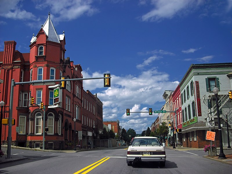
This is an image of a place or building that is listed on the National Register of Historic Places in the United States of America. Its reference number is 92000394. |
| Ìjúwe | U.S. Route 6 in Towanda, Bradford County, Pennsylvania, United States. Picture is taken within the boundaries of the Towanda Historic District, which is listed on the National Register of Historic Places. | ||
| Ọjọ́ọdún | |||
| Orísun | originally posted to Flickr as Main Street | ||
| Olùdá | Nicholas | ||
| Ìyọ̀nda (Ìtúnlò fáìlì yìí) |
Fáìlì yìí wà lábẹ́ ìwé àṣẹ Creative Commons
Ìdálórúkọ 2.0 Gbogbogbò.
|
| Object location | | View this and other nearby images on: OpenStreetMap |
|---|
Ìtàn fáìlì
Ẹ kan kliki lórí ọjọ́ọdún/àkókò kan láti wo fáìlì ọ̀ún bó ṣe hàn ní àkókò na.
| Ọjọ́ọdún/Àkókò | Àwòrán kékeré | Àwọn ìwọ̀n | Oníṣe | Àríwí | |
|---|---|---|---|---|---|
| lọ́wọ́ | 02:26, 14 Oṣù Kẹjọ 2008 | | 3,264 × 2,448 (4.32 MB) | Flickr upload bot | Uploaded from http://flickr.com/photo/14922165@N00/2755705818 using Flickr upload bot |
Ìlò fáìlì
Ojúewé kan yìí únlo fáìlì yí:
Ìlò fáìlì káàkiri
Àwọn wiki míràn wọ̀nyí lo fáìlì yìí:
- Ìlò ní ar.wikipedia.org
- Ìlò ní azb.wikipedia.org
- Ìlò ní az.wikipedia.org
- Ìlò ní bxr.wikipedia.org
- Ìlò ní ca.wikipedia.org
- Ìlò ní ceb.wikipedia.org
- Ìlò ní ce.wikipedia.org
- Ìlò ní cy.wikipedia.org
- Ìlò ní de.wikipedia.org
- Ìlò ní en.wikipedia.org
- Ìlò ní en.wikivoyage.org
- Ìlò ní es.wikipedia.org
- Ìlò ní et.wikipedia.org
- Ìlò ní eu.wikipedia.org
- Ìlò ní fa.wikipedia.org
- Ìlò ní fr.wikipedia.org
- Ìlò ní ga.wikipedia.org
- Ìlò ní ht.wikipedia.org
- Ìlò ní hu.wikipedia.org
- Ìlò ní hy.wikipedia.org
- Ìlò ní is.wikipedia.org
- Ìlò ní it.wikipedia.org
- Ìlò ní ja.wikipedia.org
- Ìlò ní ko.wikipedia.org
- Ìlò ní kw.wikipedia.org
- Ìlò ní la.wikipedia.org
- Ìlò ní lld.wikipedia.org
- Ìlò ní mi.wikipedia.org
- Ìlò ní mn.wikipedia.org
- Ìlò ní nl.wikipedia.org
- Ìlò ní no.wikipedia.org
- Ìlò ní pap.wikipedia.org
- Ìlò ní pl.wikipedia.org
- Ìlò ní pt.wikipedia.org
- Ìlò ní ro.wikipedia.org
- Ìlò ní ru.wikipedia.org
- Ìlò ní sh.wikipedia.org
Ìfihàn ìlò míràn púpọ̀ fún fálì yìí.