Fáìlì:USATopographicalMap.jpg
Ìtóbi ìkọ́yẹ̀wò yìí: 800 × 527 pixels. Àwọn ìgbéhàn míràn: 320 × 211 pixels | 640 × 422 pixels | 1,024 × 674 pixels | 1,280 × 843 pixels | 2,560 × 1,686 pixels | 3,199 × 2,107 pixels.
Fáìlì àtìbẹ̀rẹ̀ (3,199 × 2,107 pixel, ìtóbi faili: 11.19 MB, irú MIME: image/jpeg)
|
|
Fáìlì yìí wá láti Wikimedia Commons. Àròyé láti ojúewé ìjúwe rẹ̀ níbẹ̀ nìyí nísàlẹ̀. |
Àkótán
| Ìjúwe |
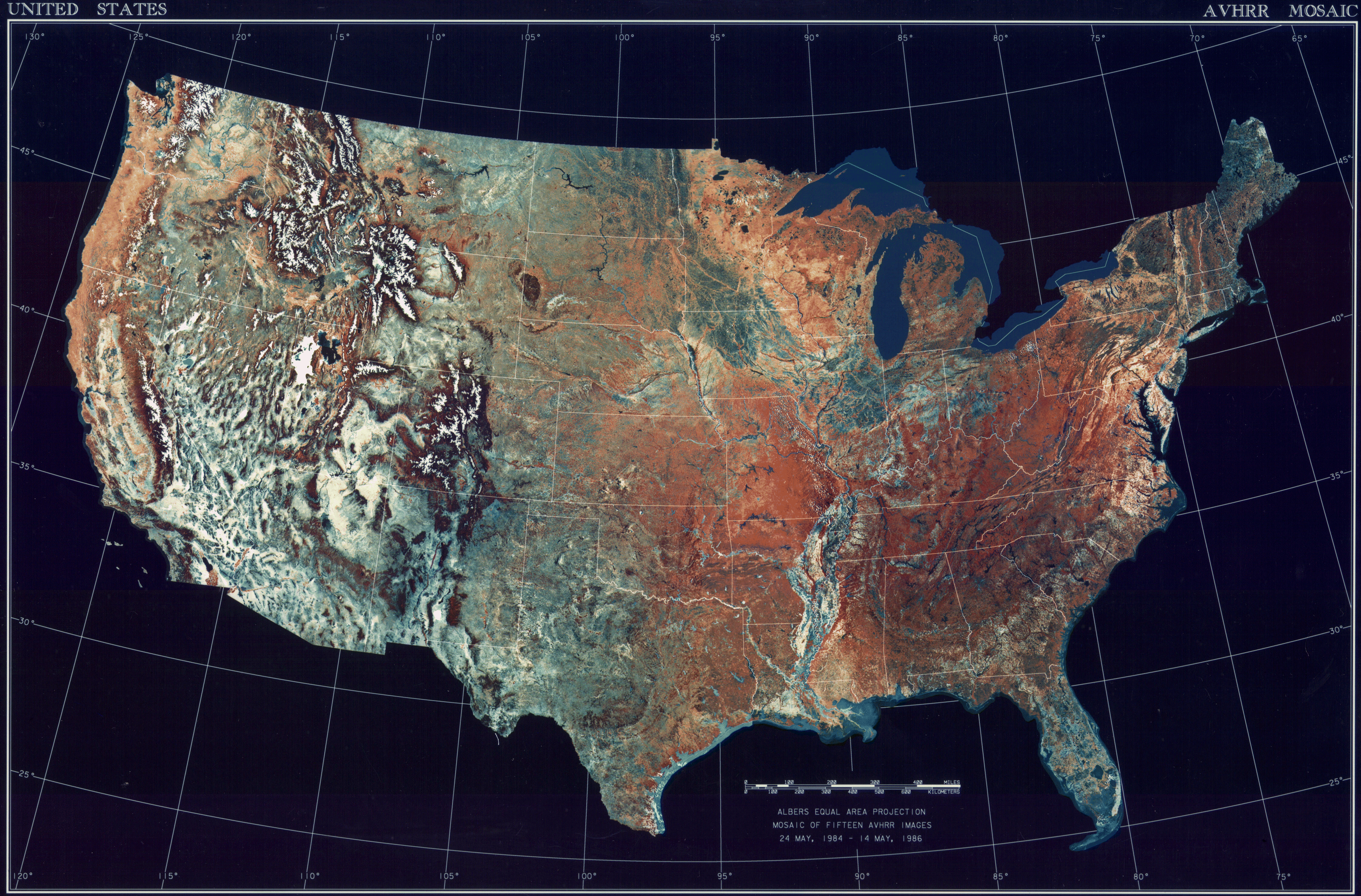
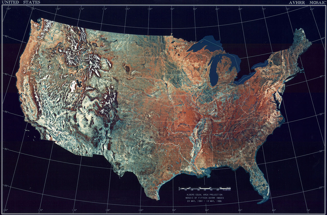
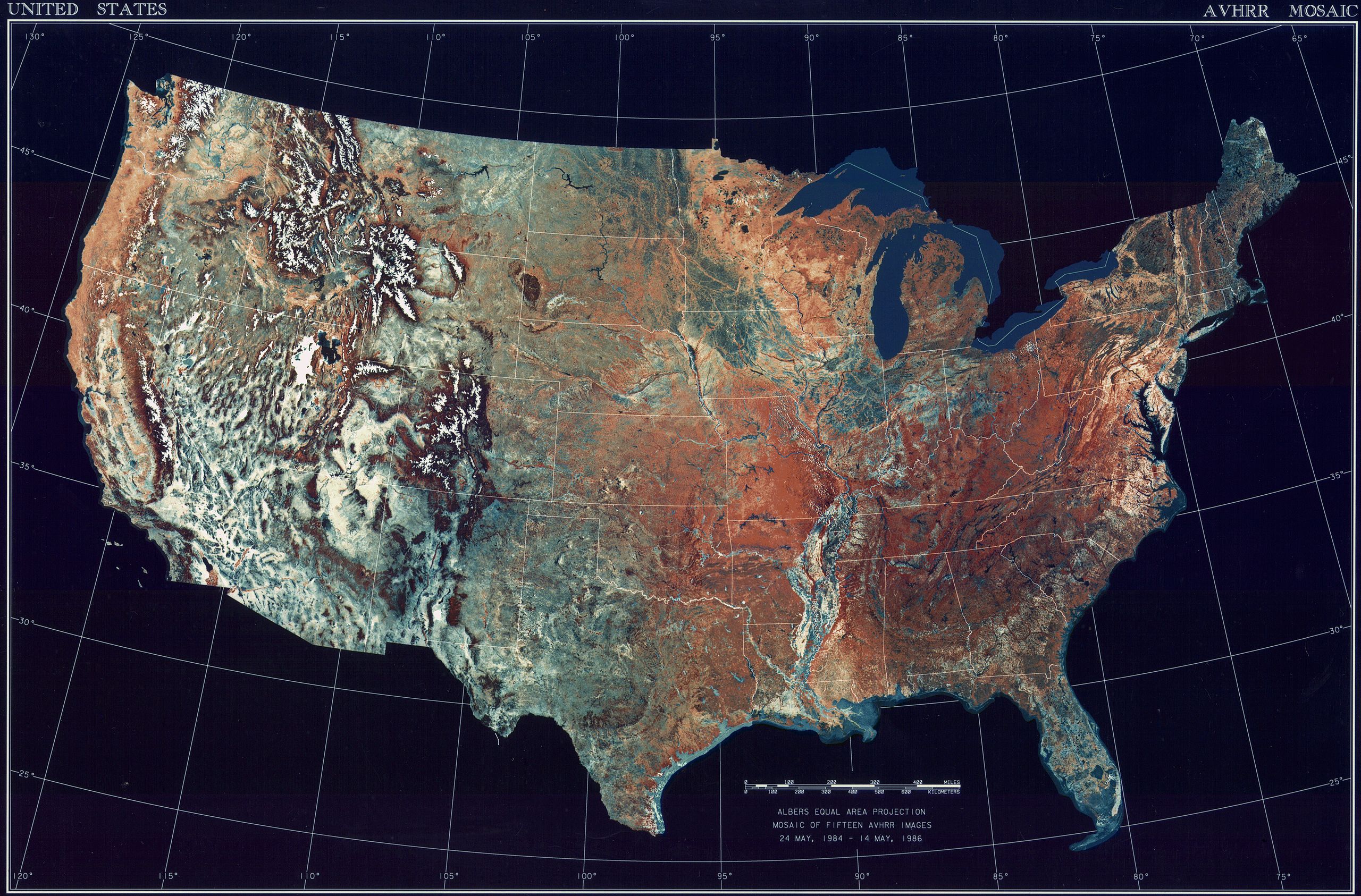
Deutsch: Satellitenbild der 48 Zentralstaaten der Vereinigten Staaten.
|
| Ọjọ́ọdún | 24 Oṣù Kàrún 1984 - 14 Oṣù Kàrún 1986 |
| Orísun | National Climactic Data Center/NOAA Satellite and Information Service |
| Olùdá | U.S. Dept. of Commerce/National Climactic Data Center/NOAA Satellite and Information Service |
Ìwé àṣẹ
This image is in the public domain because it contains materials that originally came from the U.S. National Oceanic and Atmospheric Administration, taken or made as part of an employee's official duties.
|
Ìtàn fáìlì
Ẹ kan kliki lórí ọjọ́ọdún/àkókò kan láti wo fáìlì ọ̀ún bó ṣe hàn ní àkókò na.
| Ọjọ́ọdún/Àkókò | Àwòrán kékeré | Àwọn ìwọ̀n | Oníṣe | Àríwí | |
|---|---|---|---|---|---|
| lọ́wọ́ | 08:06, 25 Oṣù Kẹ̀wá 2013 | | 3,199 × 2,107 (11.19 MB) | McZusatz | compression (uploaded using chunked upload script) |
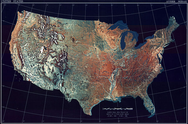
| 17:33, 4 Oṣù Kẹta 2009 |  | 3,199 × 2,107 (450 KB) | File Upload Bot (Magnus Manske) | {{BotMoveToCommons|en.wikipedia|year={{subst:CURRENTYEAR}}|month={{subst:CURRENTMONTHNAME}}|day={{subst:CURRENTDAY}}}} {{Information |Description={{en|Topographical map of the United States}} |Source=Transferred from [http://en.wikipedia.org en.wikipedia |
Ìlò fáìlì
Ojúewé kan yìí únlo fáìlì yí:
Ìlò fáìlì káàkiri
Àwọn wiki míràn wọ̀nyí lo fáìlì yìí:
- Ìlò ní ar.wikipedia.org
- Ìlò ní arz.wikipedia.org
- Ìlò ní ceb.wikipedia.org
- Ìlò ní de.wikipedia.org
- Ìlò ní el.wikipedia.org
- Ìlò ní en.wikipedia.org
- Ìlò ní es.wikipedia.org
- Ìlò ní fa.wikipedia.org
- Ìlò ní fr.wikipedia.org
- Ìlò ní fy.wikipedia.org
- Ìlò ní gu.wikipedia.org
- Ìlò ní he.wikipedia.org
- Ìlò ní ia.wikipedia.org
- Ìlò ní incubator.wikimedia.org
- Ìlò ní kn.wikipedia.org
- Ìlò ní la.wikipedia.org
- Ìlò ní lt.wikipedia.org
- Ìlò ní mnw.wikipedia.org
- Ìlò ní ms.wikipedia.org
- Ìlò ní my.wikipedia.org
- Ìlò ní pap.wikipedia.org
- Ìlò ní sq.wikipedia.org
- Ìlò ní sv.wikipedia.org
- Ìlò ní sw.wikipedia.org
- Ìlò ní ta.wikipedia.org
- Ìlò ní tcy.wikipedia.org
- Ìlò ní th.wikipedia.org
- Ìlò ní tl.wikipedia.org
- Ìlò ní uk.wikipedia.org
- Ìlò ní www.wikidata.org