Fáìlì:Niger, Route N4 near Sarando Béné.jpg
Ìtóbi ìkọ́yẹ̀wò yìí: 800 × 450 pixels. Àwọn ìgbéhàn míràn: 320 × 180 pixels | 640 × 360 pixels | 1,024 × 576 pixels | 1,280 × 720 pixels | 2,560 × 1,440 pixels | 4,000 × 2,250 pixels.
Fáìlì àtìbẹ̀rẹ̀ (4,000 × 2,250 pixel, ìtóbi faili: 3.46 MB, irú MIME: image/jpeg)
|
|
Fáìlì yìí wá láti Wikimedia Commons. Àròyé láti ojúewé ìjúwe rẹ̀ níbẹ̀ nìyí nísàlẹ̀. |
Àkótán
| Ìjúwe |
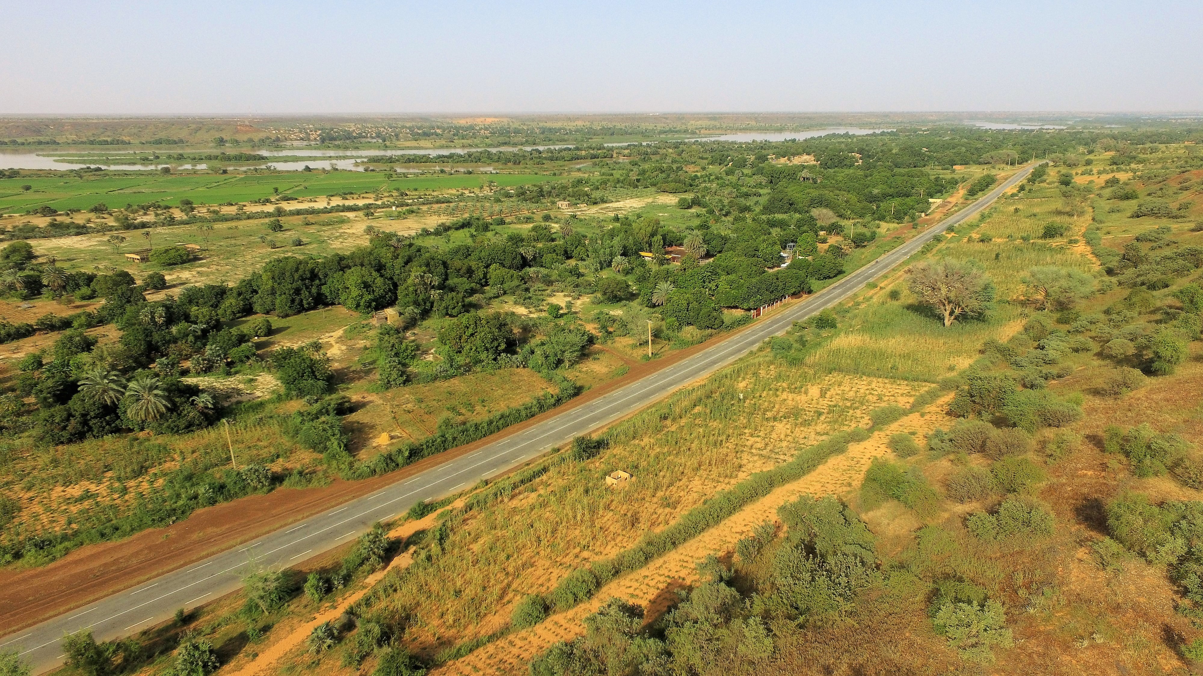
English: The National Road No.4 in Niger runs from Niamey to Tera and is seen here 1 km west of the village of Sarando Béné, looking toward Niamey. In the distance is the river Niger and on its other side the village of Boubon (left, far away).
Français : La route nationale n° 4 au Niger va de Niamey à Tera et est vue ici à 1 km à l'ouest du village de Sarando Béné. Au loin se trouve le fleuve Niger et de l'autre côté le village de Boubon (à gauche, loin). |
| Ọjọ́ọdún | |
| Orísun | Iṣẹ́ onítọ̀hún |
| Olùdá | NigerTZai |
Looking to the East-North-east from here:
| Camera location | | View this and other nearby images on: OpenStreetMap |
|---|
Ìwé àṣẹ
Èmi gangan, tó jẹ́ pé èmi ni mo ni ẹ̀tọ́àwòkọ iṣẹ́ yìí, fara mọ́ ọ láti tẹ̀ẹ́jáde lábẹ́ àwọn ìwé-àṣẹ ìsàlẹ̀ yìí:
This file is licensed under the Creative Commons Attribution-Share Alike 4.0 International license.
- Ẹ ní ààyè:
- láti pín pẹ̀lú ẹlòmíràn – láti ṣàwòkọ, pínkiri àti ṣàgbéká iṣẹ́ náà
- láti túndàpọ̀ – láti mulò mọ́ iṣẹ́ míràn
- Lábẹ́ àwọn àdéhùn wọ̀nyí:
- ìdárúkọ – Ẹ gbọdọ̀ ṣe ọ̀wọ̀ tó yẹ, pèsè ìjápọ̀ sí ìwé-àṣe, kí ẹ sì sọ bóyá ìyípadà wáyé. Ẹ le ṣe èyí lórísi ọ̀nà tó bojúmu, sùgbọ́n tí kò ní dà bii pé oníìwé-àṣe fọwọ́ sí yín tàbí lílò yín.
- share alike – Tó bá ṣe pé ẹ ṣ'àtúndàlú, ṣàyípadà, tàbí ṣ'àgbélé sí iṣẹ́-ọwọ́ náà, ẹ lè ṣe ìgbésíta àfikún yín lábẹ́ ìwé-àṣẹ kannáà tàbí tójọra mọ́ ti àtilẹ̀wa.

|
Ìyọ̀nda wà láti ṣe àwòkọ, láti pínkàkiri àti/tàbí ṣ'àtúnse ìwé yìí l'ábẹ́ àwọn ọ̀rọ̀ àdéhùn GNU Free Documentation License, Version 1.2 tàbí ìtẹ̀jáde ọjọ́ọwájú lát'ọwọ́ Free Software Foundation; láìsí àwọn Ẹsẹ Aláìyàtọ̀, láìsí àwọn Ọ̀rọ̀-ìwé Níwájú, àti láìsí Ọ̀rọ̀-ìwé Lẹ́yìn. Àwòkọ ìwé àṣẹ náà jẹ́ sísopọ̀ mọ́ abala tí àkọlé rẹ̀ jẹ́ GNU Free Documentation License. |
Ẹ le ṣàmúyàn ìwé-àṣẹ tí ó wù yín.
Ìtàn fáìlì
Ẹ kan kliki lórí ọjọ́ọdún/àkókò kan láti wo fáìlì ọ̀ún bó ṣe hàn ní àkókò na.
| Ọjọ́ọdún/Àkókò | Àwòrán kékeré | Àwọn ìwọ̀n | Oníṣe | Àríwí | |
|---|---|---|---|---|---|
| lọ́wọ́ | 19:30, 22 Oṣù Igbe 2020 | | 4,000 × 2,250 (3.46 MB) | NigerTZai | {{Information |description ={{en|1=The National Road No.4 in Niger runs from Niamey to Tera and is seen here 1 km west of the village of Sarando Béné, looking toward Niamey. In the distance is the river Niger and on its other side the village of Boubon (left, far away).}} {{fr|1= La route nationale n° 4 au Niger va de Niamey à Tera et est vue ici à 1 km à l'ouest du village de Sarando Béné. Au loin se trouve le fleuve Niger et de l'autre côté le village de Boubon (à gauche, loin).}} |date... |
Ìlò fáìlì
Ojúewé kan yìí únlo fáìlì yí:
Ìlò fáìlì káàkiri
Àwọn wiki míràn wọ̀nyí lo fáìlì yìí:
- Ìlò ní ceb.wikipedia.org
- Ìlò ní de.wikipedia.org
- Ìlò ní en.wikipedia.org
- Ìlò ní es.wikipedia.org
- Ìlò ní fr.wikipedia.org
- Ìlò ní ha.wikipedia.org
- Ìlò ní ro.wikipedia.org
- Ìlò ní www.wikidata.org
- Ìlò ní zu.wikipedia.org