Fáìlì:Northern Ghana districts.png
Fáìlì àtìbẹ̀rẹ̀ (1,056 × 816 pixel, ìtóbi faili: 49 KB, irú MIME: image/png)
|
|
Fáìlì yìí wá láti Wikimedia Commons. Àròyé láti ojúewé ìjúwe rẹ̀ níbẹ̀ nìyí nísàlẹ̀. |
Àkótán
| Ìjúwe |
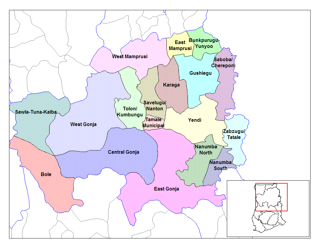
from en:districts of ghana Map of the districts of the Northern region of Ghana. Created by Rarelibra for public domain use. Created using MapInfo Professional v7.5 and various mapping resources.11 I, the creator of this work, hereby release it into the public domain. This applies worldwide. In case this is not legally possible, I grant any entity the right to use this work for any purpose, without any conditions, unless such conditions are required by law. File history |
| Ọjọ́ọdún | 28 Oṣù Kẹfà 2006 (original upload date) |
| Orísun | No machine-readable source provided. Own work assumed (based on copyright claims). |
| Olùdá | No machine-readable author provided. Ahanta assumed (based on copyright claims). |
Ìwé àṣẹ
| Èmi gangan, tó jẹ́ pé èmi ni mo ni ẹ̀tọ́àwòkọ iṣẹ́ yìí, jọ̀wọ́ ìṣẹ́ yìí sínú ìgboro. Èyí kan gbogbo ayé. In some countries this may not be legally possible; if so: I grant anyone the right to use this work for any purpose, without any conditions, unless such conditions are required by law. |
Ìtàn fáìlì
Ẹ kan kliki lórí ọjọ́ọdún/àkókò kan láti wo fáìlì ọ̀ún bó ṣe hàn ní àkókò na.
| Ọjọ́ọdún/Àkókò | Àwòrán kékeré | Àwọn ìwọ̀n | Oníṣe | Àríwí | |
|---|---|---|---|---|---|
| lọ́wọ́ | 10:53, 28 Oṣù Òkúdu 2006 | | 1,056 × 816 (49 KB) | Ahanta | from en:districts of ghana Map of the districts of the Northern region of Ghana. Created by Rarelibra for public domain use. Created using MapInfo Professional v7.5 and various mapping resources. I, the creator of this work, hereby release it into the p |
Ìlò fáìlì
Ojúewé kan yìí únlo fáìlì yí:
Ìlò fáìlì káàkiri
Àwọn wiki míràn wọ̀nyí lo fáìlì yìí:
- Ìlò ní ca.wikipedia.org
- Ìlò ní ceb.wikipedia.org
- Ìlò ní dag.wikipedia.org
- Ìlò ní da.wikipedia.org
- Ìlò ní de.wikipedia.org
- Ìlò ní en.wikipedia.org
- Tolon-Kumbungu District
- Zabzugu-Tatale District
- User talk:Rarelibra/Maps2
- List of hospitals in Ghana
- List of Ghana Parliament constituencies
- Yendi Municipal District
- User:GerardM/Districts of Ghana
- Bunkpurugu-Yunyoo District
- Saboba-Chereponi District
- Nanumba District
- Gushegu-Karaga District
- Mamprusi District
- West Dagomba District
- East Dagomba District
- Ìlò ní es.wikipedia.org
- Ìlò ní fa.wikipedia.org
- Ìlò ní fr.wikipedia.org
- Ìlò ní gpe.wikipedia.org
- Ìlò ní ha.wikipedia.org
- Ìlò ní ig.wikipedia.org
- Ìlò ní it.wikipedia.org
Ìfihàn ìlò míràn púpọ̀ fún fálì yìí.