Fáìlì:Plateau communes.png
Ìtóbi ìkọ́yẹ̀wò yìí: 776 × 600 pixels. Àwọn ìgbéhàn míràn: 311 × 240 pixels | 621 × 480 pixels | 994 × 768 pixels | 1,056 × 816 pixels.
Fáìlì àtìbẹ̀rẹ̀ (1,056 × 816 pixel, ìtóbi faili: 27 KB, irú MIME: image/png)
|
|
Fáìlì yìí wá láti Wikimedia Commons. Àròyé láti ojúewé ìjúwe rẹ̀ níbẹ̀ nìyí nísàlẹ̀. |
Àkótán
| Ìjúwe |
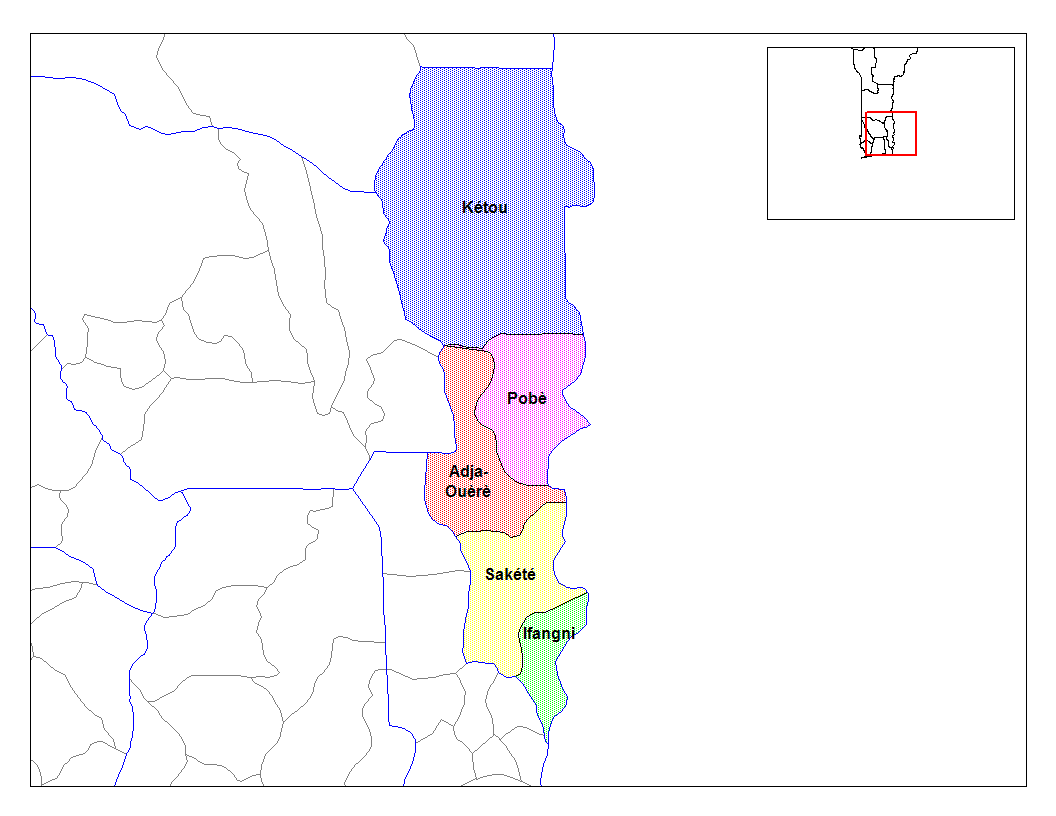
English: Map of the communes of the department of Plateau, Benin. Created by Rarelibra for public domain use. Created using MapInfo Professional v7.5 and various mapping resources. |
| Ọjọ́ọdún | 5 Oṣù Kẹta 2006 (original upload date) |
| Orísun | Transferred from en.wikipedia to Commons. |
| Olùdá | Rarelibra at Èdè Gẹ̀ẹ́sì Wikipédìà |
Ìwé àṣẹ
| This work has been released into the public domain by its author, Rarelibra at Èdè Gẹ̀ẹ́sì Wikipédìà. This applies worldwide. In some countries this may not be legally possible; if so: Rarelibra grants anyone the right to use this work for any purpose, without any conditions, unless such conditions are required by law. |
Original upload log
The original description page was here. All following user names refer to en.wikipedia.
- 2006-03-05 02:58 Rarelibra 1056×816× (27153 bytes) Map of the communes of the department of Plateau, Benin. Created by Rarelibra for public domain use. Created using MapInfo Professional v7.5 and various mapping resources.
Ìtàn fáìlì
Ẹ kan kliki lórí ọjọ́ọdún/àkókò kan láti wo fáìlì ọ̀ún bó ṣe hàn ní àkókò na.
| Ọjọ́ọdún/Àkókò | Àwòrán kékeré | Àwọn ìwọ̀n | Oníṣe | Àríwí | |
|---|---|---|---|---|---|
| lọ́wọ́ | 10:37, 28 Oṣù Kẹrin 2010 | | 1,056 × 816 (27 KB) | Deadstar | larger size file from en: wiki |
| 15:16, 17 Oṣù Kejì 2007 |  | 776 × 600 (112 KB) | Reyos | from http://en.wikipedia.org/wiki/Image:Plateau_communes.png |
Ìlò fáìlì
Ojúewé kan yìí únlo fáìlì yí:
Ìlò fáìlì káàkiri
Àwọn wiki míràn wọ̀nyí lo fáìlì yìí:
- Ìlò ní ar.wikipedia.org
- Ìlò ní ca.wikipedia.org
- Ìlò ní ceb.wikipedia.org
- Ìlò ní de.wikipedia.org
- Ìlò ní en.wikipedia.org
- Ìlò ní eo.wikipedia.org
- Ìlò ní es.wikipedia.org
- Ìlò ní fi.wikipedia.org
- Ìlò ní frr.wikipedia.org
- Ìlò ní fr.wikipedia.org
- Ìlò ní ha.wikipedia.org
- Ìlò ní hu.wikipedia.org
- Ìlò ní id.wikipedia.org
- Ìlò ní ig.wikipedia.org
- Ìlò ní it.wikipedia.org
- Ìlò ní ja.wikipedia.org
- Ìlò ní lt.wikipedia.org
- Ìlò ní nl.wikipedia.org
- Ìlò ní pt.wikipedia.org
- Ìlò ní ro.wikipedia.org
- Ìlò ní sv.wikipedia.org
- Ìlò ní sw.wikipedia.org
- Ìlò ní tr.wikipedia.org
- Ìlò ní ts.wikipedia.org
Ìfihàn ìlò míràn púpọ̀ fún fálì yìí.