Fáìlì:Volta districts.png
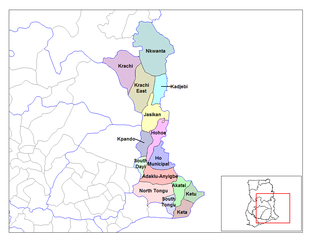
Ìtóbi ìkọ́yẹ̀wò yìí: 776 × 600 pixels. Àwọn ìgbéhàn míràn: 311 × 240 pixels | 621 × 480 pixels | 994 × 768 pixels | 1,056 × 816 pixels.
Fáìlì àtìbẹ̀rẹ̀ (1,056 × 816 pixel, ìtóbi faili: 43 KB, irú MIME: image/png)
|
|
Fáìlì yìí wá láti Wikimedia Commons. Àròyé láti ojúewé ìjúwe rẹ̀ níbẹ̀ nìyí nísàlẹ̀. |
Àkótán
| Ìjúwe |
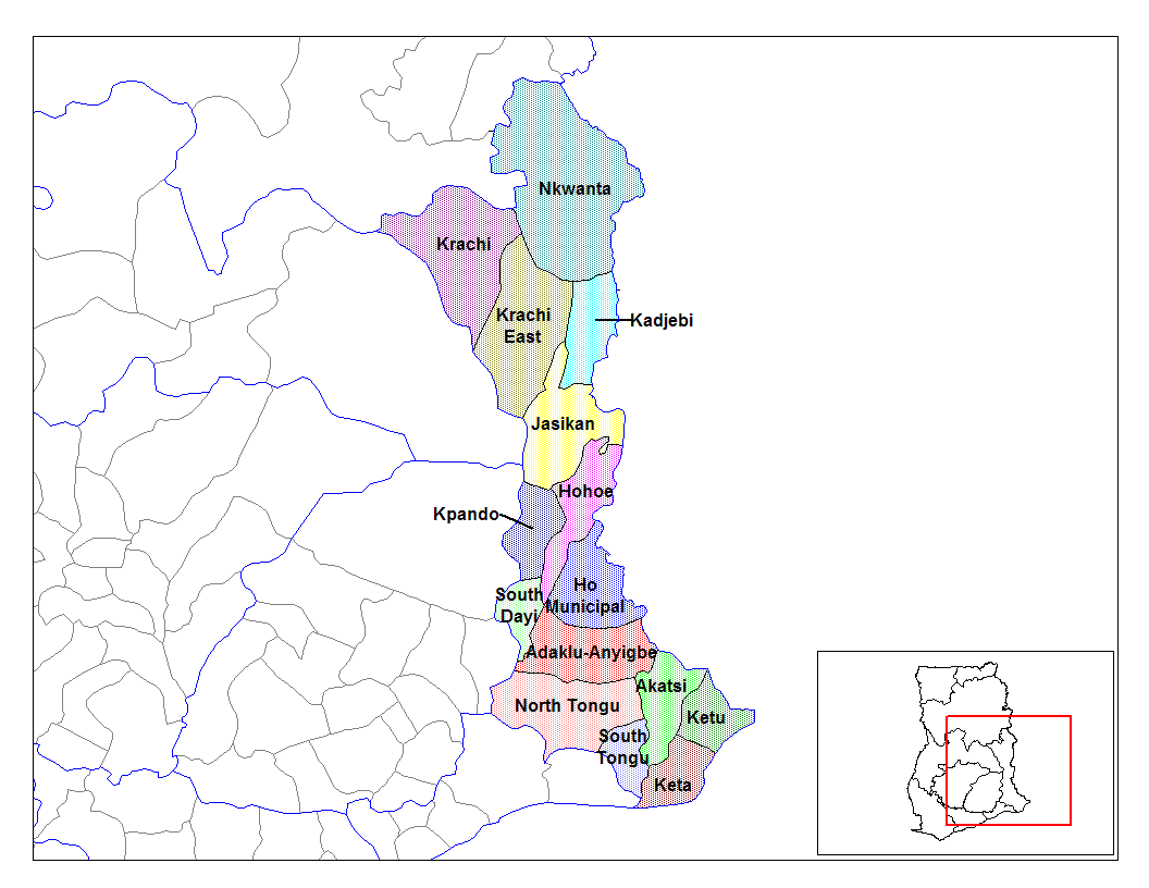
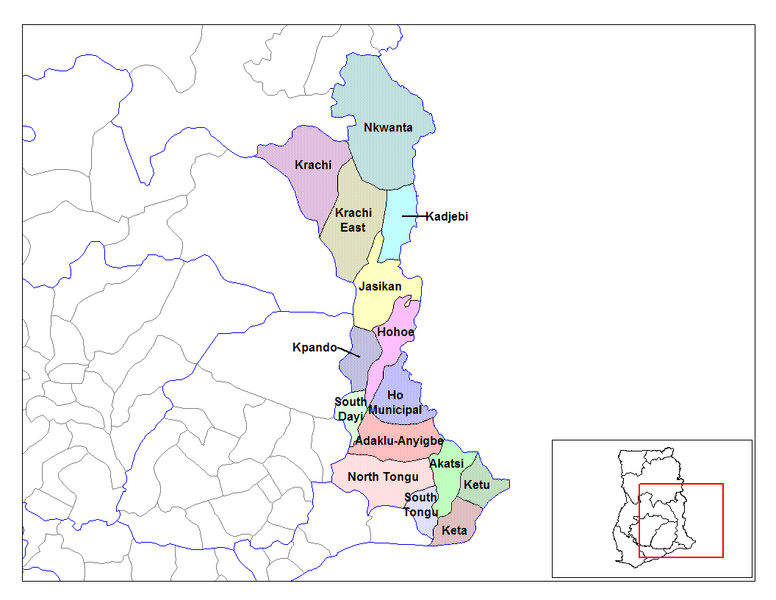
English: Map of the districts of the Volta region of Ghana. Created by Rarelibra for public domain use. Created using MapInfo Professional v7.5 and various mapping resources. |
| Ọjọ́ọdún | 28 Oṣù Kẹfà 2006 (original upload date) |
| Orísun | Iṣẹ́ onítọ̀hún |
| Olùdá | User:Rarelibra |
Ìwé àṣẹ
| Èmi gangan, tó jẹ́ pé èmi ni mo ni ẹ̀tọ́àwòkọ iṣẹ́ yìí, jọ̀wọ́ ìṣẹ́ yìí sínú ìgboro. Èyí kan gbogbo ayé. In some countries this may not be legally possible; if so: I grant anyone the right to use this work for any purpose, without any conditions, unless such conditions are required by law. |
Original upload log
- (del) (cur) 08:03, 5 March 2006 . . Rarelibra (Talk | contribs) . . 1056x816 (44,138 bytes) (Map of the districts of the Volta region of Ghana. Created by Rarelibra for public domain use. Created using MapInfo Professional v7.5 and various mapping resources.)
Ìtàn fáìlì
Ẹ kan kliki lórí ọjọ́ọdún/àkókò kan láti wo fáìlì ọ̀ún bó ṣe hàn ní àkókò na.
| Ọjọ́ọdún/Àkókò | Àwòrán kékeré | Àwọn ìwọ̀n | Oníṣe | Àríwí | |
|---|---|---|---|---|---|
| lọ́wọ́ | 14:01, 28 Oṣù Òkúdu 2006 | | 1,056 × 816 (43 KB) | Ahanta | from en:districts of ghana Map of the districts of the Volta region of Ghana. Created by Rarelibra for public domain use. Created using MapInfo Professional v7.5 and various mapping resources. [edit] I, the creator of this work, hereby release it into th |
Ìlò fáìlì
Ojúewé kan yìí únlo fáìlì yí:
Ìlò fáìlì káàkiri
Àwọn wiki míràn wọ̀nyí lo fáìlì yìí:
- Ìlò ní ca.wikipedia.org
- Ìlò ní ceb.wikipedia.org
- Ìlò ní dag.wikipedia.org
- Ìlò ní da.wikipedia.org
- Ìlò ní de.wikipedia.org
- Ìlò ní ee.wikipedia.org
- Ìlò ní en.wikipedia.org
- Ìlò ní es.wikipedia.org
- Ìlò ní fa.wikipedia.org
- Ìlò ní fr.wikipedia.org
- District (Ghana)
- Région de la Volta
- Adaklu-Anyigbe
- Akatsi
- Dayi sud
- Tongu nord
- Tongu sud
- Nkwanta sud
- Kpando
- Kadjebi
- Jasikan
- District municipal de Keta
- Ketu sud
- Ketu nord
- Nkwanta nord
- Biakoye
- District municipal d'Ho
- District municipal d'Hohoe
- Krachi est
- Krachi ouest
- Modèle:Infobox District du Ghana
- Modèle:Infobox District du Ghana/Documentation
- Ìlò ní gpe.wikipedia.org
- Ìlò ní ha.wikipedia.org
Ìfihàn ìlò míràn púpọ̀ fún fálì yìí.