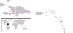
Àngúíllà
Coordinates: 18°13′14″N 63°4′7″W / 18.22056°N 63.06861°W Anguilla Nínú ètò ìkànìyàn 1995, àwọn ènìyàn tó wa ní Anguilla jẹ́ ẹgbẹ̀rún méje àti ọgọ́rùn-ún (7,100). Èdè Gẹ̀ẹ́sì ni wọ́n ń sọ níbẹ̀. Púpọ̀ nínú àwọn ènìyàn ibẹ̀ ni wọ́n ń sọ èdè Kirió tí wọ́n gbé ka èdè Gẹ̀ẹ́sì (English based Creole). Kirió yìí ni ó wọ́pọ̀ jù ní Áńtílẹ́ẹ̀sì (Lesser Antilles)
Anguilla | |
|---|---|
Motto: "Strength and Endurance" | |
 | |
| Olùìlú | The Valley |
| Àwọn èdè ìṣẹ́ọba | English |
| Àwọn ẹ̀yà ènìyàn | 90.1% West African, 4.6% Multiracial, 3.7% European, 1.5% other[1] |
| Orúkọ aráàlú | Anguillian |
| Ìjọba | British Overseas Territory |
• Monarch | HM Queen Elizabeth II |
• Governor | William Alistair Harrison |
| Ìdásílẹ̀ | |
| 1980 | |
| Ìtóbi | |
• Total | 91 km2 (35 sq mi) (220th) |
• Omi (%) | negligible |
| Alábùgbé | |
• 2006 estimate | 13,600[2] (212th) |
• Ìdìmọ́ra | 132/km2 (341.9/sq mi) (n/a) |
| GDP (PPP) | 2004 estimate |
• Total | $108.9 million |
• Per capita | $8,800 |
| Owóníná | East Caribbean dollar (XCD) |
| Ibi àkókò | UTC-4 |
| Ojúọ̀nà ọkọ́ | left |
| Àmì tẹlifóònù | +1-264 |
| ISO 3166 code | AI |
| Internet TLD | .ai |
| |

|
Àyọkà yìí tàbí apá rẹ̀ únfẹ́ àtúnṣe sí. Ẹ le fẹ̀ jù báyìí lọ tàbí kí ẹ ṣàtúnṣe rẹ̀ lọ́nà tí yíò mu kúnrẹ́rẹ́. Ẹ ran Wikipedia lọ́wọ́ láti fẹ̀ẹ́ jù báyìí lọ. |
Itokasi
àtúnṣe- ↑ "Anguilla World Fact Book". Archived from the original on 2020-04-07. Retrieved 2009-10-24.
- ↑ Country Profile: Anguilla, Travel & Living Abroad, Foreign & Commonwealth Office

