Fáìlì:1710 moll.jpg
Ìtóbi ìkọ́yẹ̀wò yìí: 800 × 491 pixels. Àwọn ìgbéhàn míràn: 320 × 196 pixels | 640 × 393 pixels | 1,024 × 628 pixels | 1,280 × 785 pixels | 2,560 × 1,571 pixels | 3,845 × 2,359 pixels.
Fáìlì àtìbẹ̀rẹ̀ (3,845 × 2,359 pixel, ìtóbi faili: 11.03 MB, irú MIME: image/jpeg)
|
|
Fáìlì yìí wá láti Wikimedia Commons. Àròyé láti ojúewé ìjúwe rẹ̀ níbẹ̀ nìyí nísàlẹ̀. |
Àkótán
| Ìjúwe |
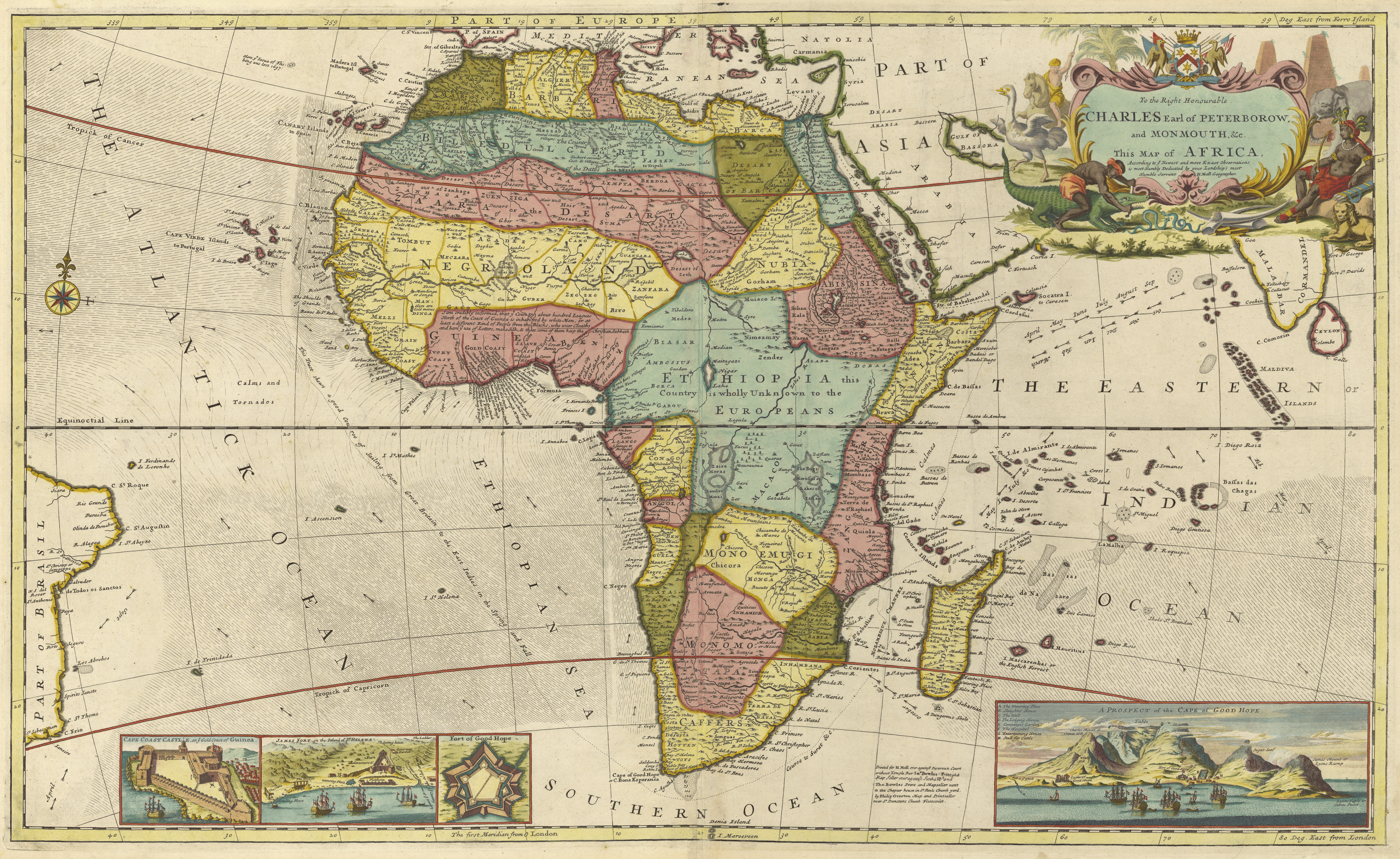
English: Early map of Africa depicting a region named Biafra |
| Ọjọ́ọdún | |
| Orísun | http://libweb5.princeton.edu/visual_materials/maps/websites/africa/maps-continent/1710%20moll.jpg |
| Olùdá | Herman Moll |
| Àwọn àtẹ̀jáde míràn |

Ìwé àṣẹ
|
This work is in the public domain in its country of origin and other countries and areas where the copyright term is the author's life plus 70 years or fewer. This work is in the public domain in the United States because it was published (or registered with the U.S. Copyright Office) before January 1, 1929. | |
| This file has been identified as being free of known restrictions under copyright law, including all related and neighboring rights. | |
Ìtàn fáìlì
Ẹ kan kliki lórí ọjọ́ọdún/àkókò kan láti wo fáìlì ọ̀ún bó ṣe hàn ní àkókò na.
| Ọjọ́ọdún/Àkókò | Àwòrán kékeré | Àwọn ìwọ̀n | Oníṣe | Àríwí | |
|---|---|---|---|---|---|
| lọ́wọ́ | 00:15, 12 Oṣù Keje 2017 | | 3,845 × 2,359 (11.03 MB) | Captainda | User created page with UploadWizard |
Ìlò fáìlì
Ojúewé kan yìí únlo fáìlì yí:
Ìlò fáìlì káàkiri
Àwọn wiki míràn wọ̀nyí lo fáìlì yìí:
- Ìlò ní en.wikipedia.org
- Ìlò ní fr.wikipedia.org
- Ìlò ní ha.wikipedia.org
- Ìlò ní mk.wikipedia.org